
Walk a Romeoville Street
A useful Romeoville street directory search moves from the place to the records. First standardize the address, then identify the parcel identification number, or PIN. That number is more stable than a typed street label and links several official systems. Ownership and occupancy are not the same. An assessment record identifies an owner for tax purposes, a deed names parties to a recorded transfer, and a voter result confirms only the registration returned for the supplied details.
Keep the spelling, unit, PIN, source, and access date. Romeoville addresses can sit near village limits, and an older source may use a Lockport postal label. Record those differences rather than erasing them.
- Standardize the full address with the USPS address-based ZIP tool.
- Use the Will County assessment address search to find the PIN.
- Compare the parcel and boundary layers in Romeoville My Place.
- Search the Recorder by address, PIN, or confirmed owner name.
- Use permits, election tools, newspapers, and directories for their narrow purposes.
Romeoville Assessor Address Search
The Will County Supervisor of Assessments Address Search supports partial entries. Address data comes from the county 9-1-1 system, so the portal is a strong locator, while the assessment office remains the source for assessment questions. Start broad with a street, then narrow with the city or PIN.
| Field | Purpose | Search note |
|---|---|---|
| Street number | One address | Leave broad to browse a street |
| Street name | Named-street list | Partial matches work |
| City | Postal filter | Compare municipal limits |
| PIN | Exact parcel key | Formatted and partial components |
| Owner name | Owner cross-check | Partial or starts-with search |
The Property Search Portal also offers sale, subdivision, owner, and property-class paths. These can separate similar names and identify parcels in one recorded subdivision.
The official assessor form appears in this capture.
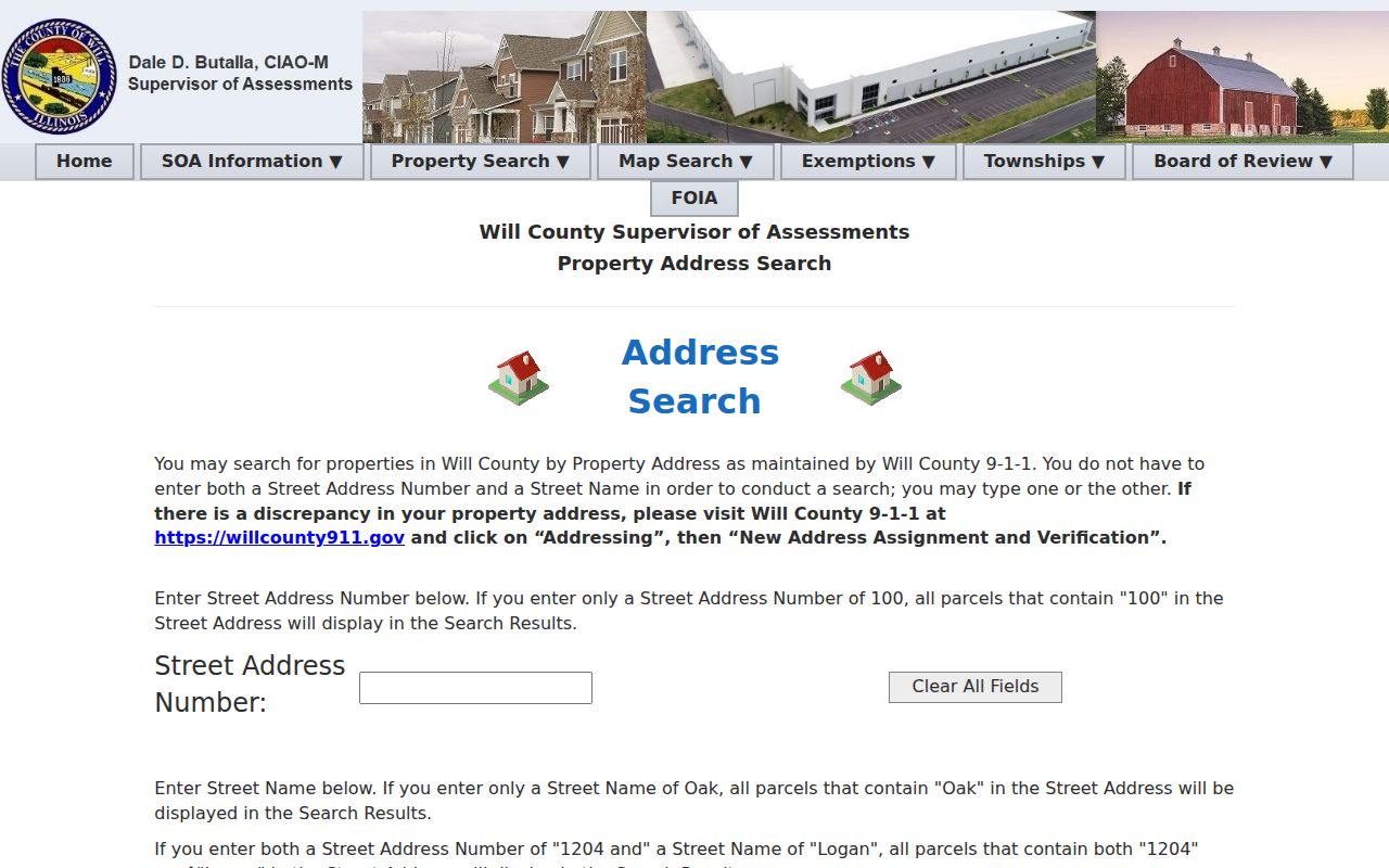
Its fields show why an owner name is not required for the first address search.
Map Romeoville Parcels Precisely
The Village GIS and Maps page links My Place address and PIN lookup plus parcel, subdivision, zoning, political-district, school, park, police-beat, enterprise-zone, and TIF maps. Its owner layer includes PIN, situs, subdivision, zoning, owner, and update fields. Situs means the parcel's physical location, which may differ from the owner's tax-mail address.
GIS is an informational map, not a survey or legal opinion. Click adjoining shapes to follow a block, then confirm facts with the assessor and Recorder. The Will County GIS Data Viewer provides a second spatial check.
Romeoville's map menu identifies the local layers.
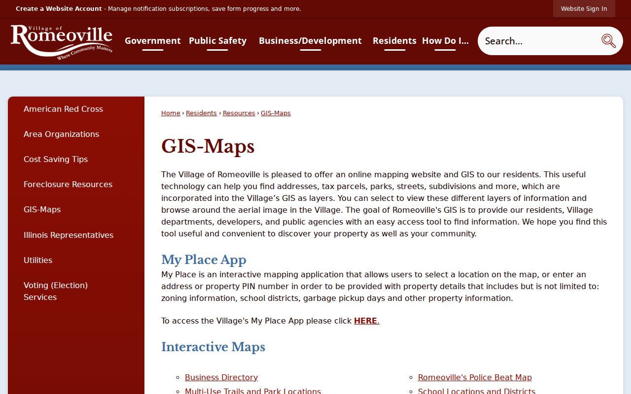
The menu helps distinguish parcel lines from zoning, subdivision, and village boundaries.
Romeoville Street Record Coverage
Records searchable by address have different keepers and meanings. A street directory must preserve the source beside each fact.
| Record | Keeper | What it shows | Access |
|---|---|---|---|
| Assessment | Supervisor of Assessments | Parcel, owner, class, sale clues | Portal, phone, office |
| GIS map | Village and County GIS | Situs, shape, subdivision, layers | Online viewers, GIS staff |
| Recorded documents | Will County Recorder | Deed parties, dates, document number | Direct Search, archives, mail, counter |
| Permits | Community Development | Projects and inspections by address | OpenGov, staff, Village FOIA |
| Voter confirmation | Will County Clerk | Registration response for supplied data | Restricted lookup, clerk contact |
| Historic print | Local libraries | Past address and household clues | Microfilm, shelves, appointment |
An assessed owner is not a household roster. A mailing address may be elsewhere, and a deed may name a trust or entity. Treat each layer on its own terms.
Search Romeoville Deeds by Address
The Recorder search instructions describe separate Name, PIN, and Address routes. Direct Search covers documents recorded from January 1, 1965 forward. Earlier material requires archive stations, microfilm, old indexes, or a directed copy request. The percent sign works as a name wildcard. Do not mix an unconfirmed name into the address search too soon.
Results can identify document number and type, recording date, party roles, legal-description clues, and image status. A grantor conveys an interest; a grantee receives it. Only the first 300 results display, so narrow a busy street by dates, type, or PIN.
Direct Search displays the official query paths.
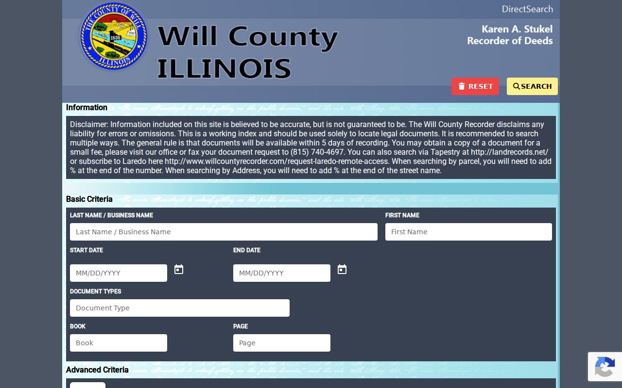
The interface separates the index lead from the document image or certified copy.
Romeoville Street Record Terms
Short property terms can alter a result's meaning. Keep these definitions beside the search log.
- Parcel
- A mapped tract connected to a tax and assessment record.
- PIN
- The identification number linking assessment, GIS, and deed searches.
- Situs address
- The physical parcel address, not always the owner's mailing address.
- Plat
- A recorded drawing dividing land into lots, blocks, streets, or easements.
- Criss-cross directory
- A directory arranged by street or phone number instead of surname.
The PIN is the best bridge, but compare it with the map and legal description when lot splits or parcel combinations complicate the label.
Romeoville Subdivisions and Limits
Romeoville publishes a subdivision map, and its GIS carries subdivision and annexation layers. A phase number or boundary can make a text match deceptive. Record the legal description and subdivision before deciding that two results concern the same land.
Annexation layers carry year labels from incorporation through later growth, but a layer is not the annexation ordinance. Ask the Village Clerk for the ordinance if the year matters. This check is vital near Bolingbrook, Lockport, Lemont, Plainfield, Crest Hill, and Joliet.
Note: A Romeoville mailing label can identify postal service without proving that a parcel lies inside present village limits.
The 1835 Romeo Plat
The place-name trail predates Will County. Village history says Romeo was platted in 1835 and recorded in Cook County before Will County formed in 1836. The village incorporated in 1895 after a 42 to 20 vote at John Miller's barbershop, and the name became Romeoville. Old land research may therefore demand a different county, place name, and series than a modern street directory suggests.
Retain “Romeo” exactly in notes, then bridge it to the modern PIN, map, subdivision, and deed chain. The history establishes context; official land records establish the parcel.
Romeoville Permits by Address
Community Development routes building permits and inspection records through online services and staff. Such files can confirm a project, inspection type, number, or date tied to a place. They do not prove who occupied it. Search the address, then request a narrow date range when the online tool falls short.
Romeoville accepts written records requests electronically and by other delivery methods. The Village FOIA page is the fallback. Identify the record, address, date span, and department. Illinois FOIA ordinarily allows five business days, subject to legal extensions and exemptions.
Past Romeoville Streets in Print
Modern parcel records cannot identify every past occupant. White Oak Public Library's Romeoville Branch holds local newspaper microfilm, yearbooks, and newsletters. Joliet Public Library adds Will County directories, newspapers, maps, plat books, obituary indexes, and research appointments. No dedicated official Romeoville criss-cross directory was found, so begin with library staff and the Historical Society.
Search street spellings, surnames, subdivisions, and dates. Ask whether a volume includes a householder or address section. The Romeoville Directory Book covers the historical shelf. A missing entry or year does not prove that a family moved.
Verify Romeoville Street Findings
A useful packet combines a parcel result, deed-index result, and one address-linked municipal or archive item. Save query fields and dates. Redact names, birth dates, phones, and account data from shared samples. Each custodian can correct only its own record.
Official rolls disclose their scope. Commercial people-finder products may merge people or retain stale addresses, so they cannot replace county and village records. For one named person rather than a whole road, use the Romeoville resident lookup.
Romeoville Street Directory Limits
A street directory cannot list all occupants. Property rolls concern parcels and owners. Voter tools require identifying facts and are not browseable household lists. Driver and utility data are protected, court systems restrict redistribution, and safety programs may shield an address. A blank result can reflect privacy, spelling, timing, coverage, or jurisdiction.
Use address records for genealogy, parcel history, scam checks, civic questions, and other lawful personal work. Confirm important facts with the custodian, and never republish a sensitive address merely because it appeared in a record.
Lawful use. Romeoville address records must not be used to stalk, harass, threaten, intimidate, or harm any person.
Romeoville Street Directory Offline
An online failure does not end an address search. The Will County Recorder maintains public archive stations and microfilm at 158 North Scott Street in Joliet. Staff can route copy requests when a researcher supplies a document number, party, legal description, recording date, or another exact key. The Supervisor of Assessments offers telephone, counter, and contact-form help for parcel questions. Township assessors remain part of the assessment chain. County GIS staff answer map and data questions, while the village GIS staff can explain Romeoville layers.
For permits or inspection files, contact Romeoville Community Development before filing a broad request. The Village Clerk routes municipal FOIA matters. Election questions belong with the Will County Clerk at 302 North Chicago Street in Joliet. Historical address work can move offline to White Oak's Romeoville Branch, Joliet Public Library research appointments, the Romeoville Area Historical Society, and the Illinois Regional Archives Depository route for Will County records.
Give staff a street, surname, date span, publication title, and record type. Ask which years and formats exist. A narrow request is easier to reproduce and less likely to combine unrelated households. Log a negative answer too, since a confirmed gap can prevent another searcher from mistaking missing coverage for proof that a person was absent.
Note: Record the custodian and access channel even when staff report that no responsive index, image, map, or directory volume exists.