
Romeoville ZIP Directory Coverage
Official sources document 60446 as Romeoville's primary postal ZIP. The Romeoville Post Office is at 160 N Independence Boulevard and lists 815-886-9040. Research did not locate a second post office or another ZIP explicitly assigned to incorporated Romeoville. That makes a one-row coverage table more accurate than padding the Romeoville ZIP code directory with nearby codes that merely appear in regional material.
| ZIP | Documented Romeoville use | Postal station | Boundary caution |
|---|---|---|---|
| 60446 | Primary official Romeoville postal label | Romeoville Post Office | Validate each parcel; a ZIP is not the Village limit |
Nearby 60440, 60441, 60431, 60435, 60585, and 60586 can help orient a regional search, but the reviewed sources do not establish them as Romeoville service codes. Use them as context only. The USPS ZIP Code Lookup can standardize a real address and return its proper last line. A parcel-by-parcel result is stronger than a generalized online ZIP map.
Romeoville's Lockport Label Change
An older record can pair 60446 with Lockport without describing a different house. A 2005 USPS Postal Bulletin changed the preferred last-line city name for ZIP 60446 from Lockport to Romeoville. That postal change is a useful date marker when comparing deeds, directories, newspaper notices, and family papers.
Keep the wording printed on the original source. Then add the present USPS result and the parcel's municipal status as separate facts. Silently changing Lockport to Romeoville can erase evidence about when a document was created. Conversely, treating every old Lockport label as a different parcel can split one address history into two false trails.
Romeoville ZIP Search Fields
Not every official portal accepts a ZIP filter. The Will County Recorder's Direct Search has an Address tab with house number, street, city, and Zipcode. Romeoville's public parcel layer also exposes a ZIP Code field. By contrast, the County Supervisor of Assessments address form uses number, street, and city, with no visible ZIP box. My Place accepts a street address or PIN, which is the parcel identification number.
| Official tool | ZIP control | Other useful fields | Best role |
|---|---|---|---|
| Recorder Direct Search | Zipcode | House No, Street, City | Recorded documents tied to an address |
| Romeoville parcel layer | ZIP Code field | PIN, situs, subdivision, zoning | Compare postal and municipal geography |
| SOA Address Search | None shown | Number, Street Name, City/Town | Find the assessment parcel |
| USPS ZIP Lookup | Result from address | Street, City, State | Confirm the standardized mail line |
The distinction matters. A ZIP code directory can narrow a postal area, but the PIN and situs address identify the land record. “Situs” means the physical location of the parcel, which can differ from an owner's mailing address.
Find Romeoville Residents by ZIP
A ZIP-wide search should be a narrowing method, not a bulk resident list. Start with postal confirmation, then move to a record tied to the specific purpose. Property rolls identify assessed owners, recorded instruments identify document parties, and GIS shows mapped parcels. None is a complete roster of who occupies each home.
- Enter the full address in USPS ZIP Lookup. Save the standardized last line and ZIP+4 with the date checked.
- Find the parcel through Will County SOA Address Search. Its street text uses contains matching, and adding Romeoville narrows the results.
- Compare the PIN and situs with Village My Place GIS or the county viewer. Check the Village Limits layer before calling it a municipal address.
- Use the Recorder Address tab only when a recorded document answers the question. Confirm any match by PIN, legal description, date, and recording number.
Election lookup is not a ZIP directory. Will County's public voter tool requires a first name, last name, date of birth, and house number, and it exists for registration and ballot tasks. State voter data also carries authorized-use limits. Once the postal area narrows to a named road, the Romeoville street directory explains the street-level record chain.
Romeoville Post Office Record
The official USPS location record for Romeoville is the source for the local station, phone, services, and current retail schedule. Check it before making a trip because operating details can change.
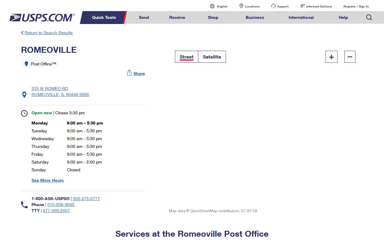
The captured station page supports 60446 as the documented local postal label. It does not draw a legal Village boundary, so pair it with parcel and municipal-limit records.
Romeoville ZIP Across Local Lines
Romeoville grew across older township and service-district patterns. White Oak Public Library's history says the community expanded south from DuPage into Lockport Township during the 1990s and early 2000s. A 2008 library-territory transfer included DuPage portions and future Romeoville areas such as Carillon. These facts concern library districts, not postal or municipal borders, but they explain why local records may sort the same area in different ways.
For a directory search, record each layer on its own line: USPS city and ZIP, incorporated municipality, township code from the PIN, library district, and subdivision. That small discipline prevents a library service boundary from being presented as a city limit. It also helps route older parcel work to the correct township assessor.
Note: Romeoville service districts can overlap without sharing the same legal boundary, so identify the custodian for each record before drawing a conclusion.
Romeoville ZIP and Village Limits
ZIP codes route mail. Village limits establish municipal jurisdiction. The Census Bureau likewise warns that ZIP Code Tabulation Areas are generalized geographic products and are not city boundaries. Therefore, a 60446 mailing line alone does not prove that Romeoville Village Hall holds the address's permits or local administrative file.
Check the Village Limits layer against the parcel geometry and PIN. If the city label and map disagree, preserve both results and ask Village GIS, the County mapping office, or the 9-1-1 addressing custodian to clarify. The Village states that its GIS is informational, not a survey or legal opinion.
- ZIP and ZIP+4
- The first five digits identify a delivery area. Four added digits narrow delivery further, but neither proves municipal jurisdiction.
- PO-box ZIP
- A code reserved for post-office-box delivery rather than ordinary street delivery. No Romeoville-only example was established in the research.
- Unique ZIP
- A code assigned to one large recipient. No unique Romeoville code was established by the reviewed official sources.
- Carrier route
- A Postal Service delivery grouping within a ZIP. It can cross boundaries used by other public agencies.
Romeoville Directories Need Postal Dates
Historical searches need the date of the postal label. A directory, obituary, or newspaper may use Romeoville, Lockport, or an older place description while still pointing to the same general area. Cite the title, issue or volume date, page, address as printed, and the later USPS or parcel match. Do not modernize the old entry inside a quotation or research note.
White Oak's Romeoville newspaper microfilm runs from 1975 through 2009 with title changes and gaps. Joliet Public Library holds county directories, maps, plat books, obituary indexes, and newspapers. Those collections can bridge the label change, though they are not proof of current occupancy. Use the Romeoville Directory Book page for the full historical collection path.
Romeoville ZIP Lookup Fallbacks
No official USPS boundary map was located for every Romeoville parcel. When the web lookup fails, use all documented access channels. Call the Romeoville Post Office at 815-886-9040 or USPS at 1-800-275-8777, visit the post office, check Village Hall's GIS resources, and contact the SOA or 9-1-1 addressing office about an address discrepancy.
For a non-exempt municipal address record that the published maps do not answer, a written request may be sent under the Illinois Freedom of Information Act. Requests can be delivered, mailed, faxed, or sent electronically, and ordinary responses are due within five business days subject to statutory extensions. Ask for a named record or address range, not an explanation or a newly made list.
That fallback chain keeps the Romeoville ZIP code directory honest: 60446 is the primary documented label, nearby codes are context, and a full address must still be checked.
Keep a short verification log for each address. Record the form used, the exact address entered, the standardized result, the parcel PIN, the municipal-limit result, and the date of access. If the Recorder Address tab supplies a document hit, note its recording number and legal field rather than copying the party name into a broad ZIP list. This method makes a Romeoville ZIP code result repeatable without implying that a postal area reveals every resident.
Current portal details can shift. USPS schedules change, assessment cycles roll forward, and GIS layers carry their own update dates. A saved result should therefore name the custodian and capture date. For a family-history question, retain the old postal wording beside the new result. For a current property question, let the parcel and legal description control.